Reconstruct the incident. Frame by frame
Stingray decodes AIS & VDR recordings into one interactive reconstruction. Built to be examined, measured and defended. In your browser, in minutes. For investigators, experts and claims teams.
- 0 guesses
- Stingray decodes from published standards and the ship’s own records. It never reverse-engineers a format.
- 7 ingest formats
- 6 NMEA dialects (VDR included) and CSV.
- 5 export formats
- MP4 video, Rhino .3dm, CSV, PNG, SVG.
- 100% in browser
- Zero install. No data has to leave your machine.
Every layer of the
incident, reconstructed
Decode the black box, show the data that matters, and measure exactly how close they came.
Decode the black box
Raw VDR & AIS resolve into one scrubbable picture. Tracks, headings and true-scale hulls, cleanly interpolated.
Decode the black box
Raw VDR & AIS resolve into one scrubbable picture. Tracks, headings and true-scale hulls, cleanly interpolated.
One reconstruction.
Four ways to see it
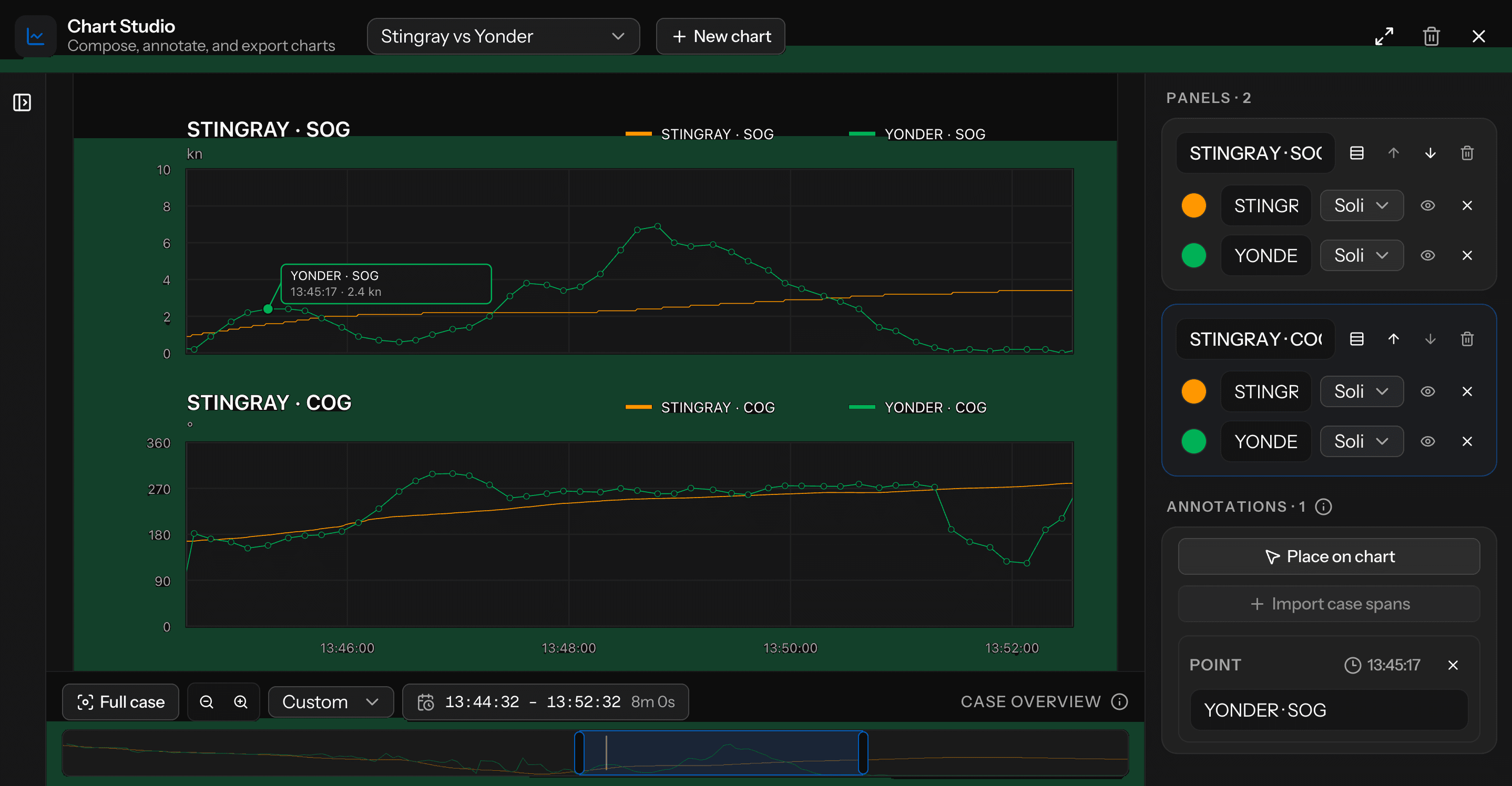
What the bridge could see. A radar PPI centred on any vessel, with range rings, trails and vectors. Exports as PNG.
Radar view
What the bridge could see. A radar PPI centred on any vessel, with range rings, trails and vectors. Exports as PNG.
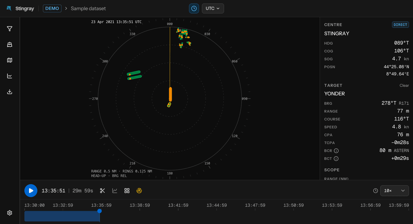
Map workspace
What actually happened. Every vessel on the chart, with tracks, live data cards and closest approach.
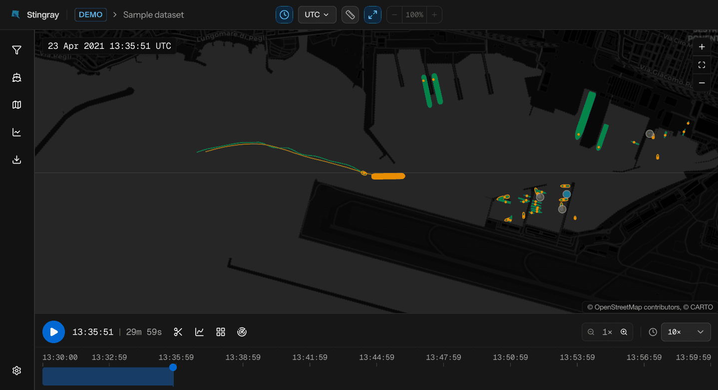
Quadrant view
The data beside the motion. The map and three synced charts in one 2×2 frame, exported as a single MP4.
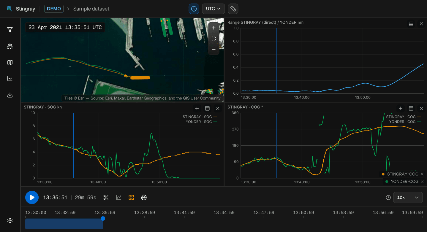
Chart Studio
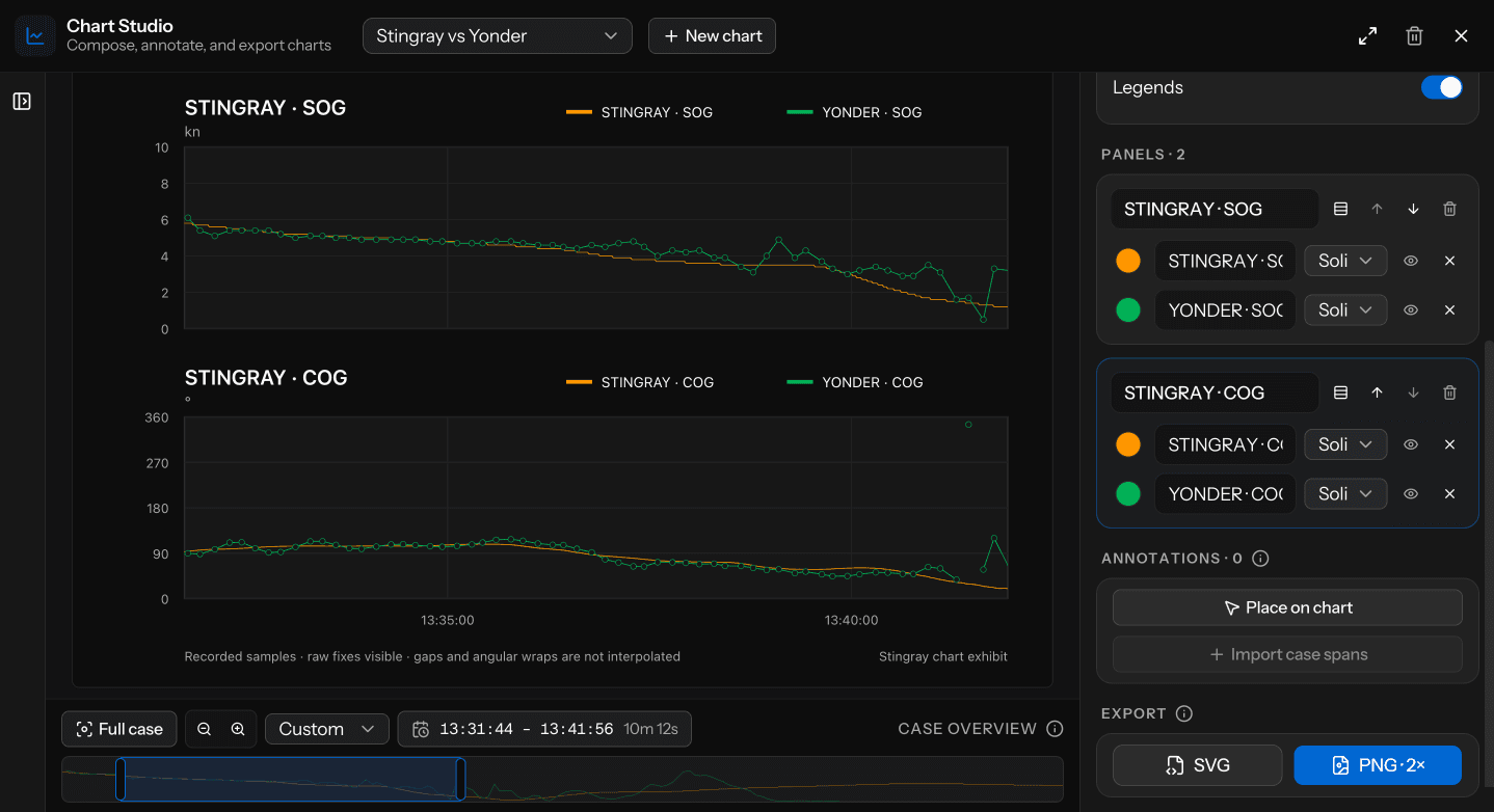
What goes in the report. Compose and annotate chart exhibits, then export them as SVG or PNG.
Built for forensic work.
Every detail an investigator needs to inspect, measure and stand behind what happened on the water.
- SIZE
- 148 × 22 m
- COG / SOG
- 98° / 3.6 kn
- STATUS
- Under way
- RUDDER
- 0° stbd
True-scale hulls, instrumented
Stingray draws hulls at their real dimensions and pins the critical numbers to each one.
Deep vessel inspection
Open any vessel: dimensions, type, nav status, identity.
- Name
- STINGRAY
- Position
- 44°25.15'N008°48.92'E
- SOG
- 3.6 kn
- HDG
- 96°
- ROT
- 0.0°/min
- Time
- 2025-09-17 11:29:26 UTC
- Colour
Provenance, embedded
Rhino exports carry their own record, readable directly from the file.
- generatedAt
- 2025-09-19T09:41:02Z
- crsLabel
- UTM 32N · EPSG:32632
- interpolationMode
- curved
- sourceManifest
- 9f2c…e41a VDR-ch10.nmea73bd…08c2 ais-genoa.csv
- sourceManifestSha256
- 4b7e…c013
Chart overlay
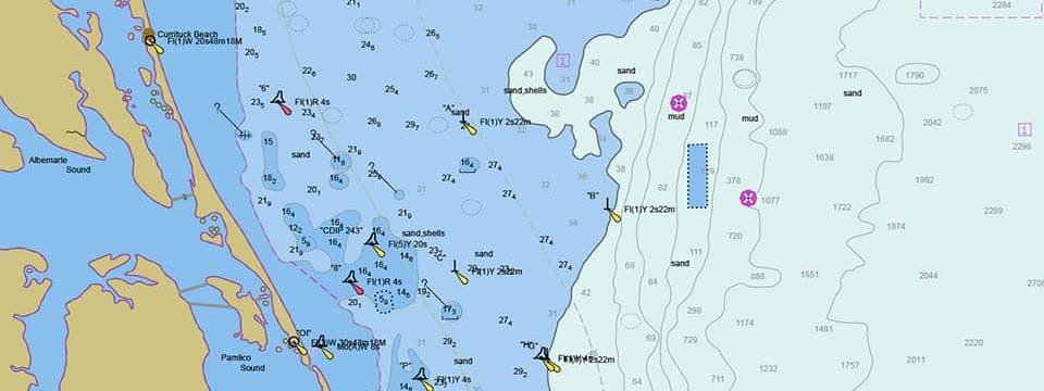
Bring your own chart, pin it to real coordinates and play the reconstruction on top of it.
Casework stays
on your machine.
Stingray parses recordings in your browser, on your hardware. The source file is never uploaded, never retained, never visible to us. Exports render locally and save where you choose.
Source recording
- NMEA
- CSV
- VDR
Parsed in browser memory. Never uploaded, and not retained after parse.
Exports
- MP4
- .3dm
- CSV
- PNG
- SVG
Generated entirely on your machine, saved through the file picker.
Project saves
- .stingray
- cloud · EU
Your choice: a local .stingray file that never leaves your machine, or encrypted cloud save for cross-device work.
See it yourself
Thirty minutes of real, anonymised traffic in the Port of Genoa.
The full analyzer. Live in your browser.
No engagement letter. No gatekept license. No sign-up.
Reconstruction should not require a procurement process.

Built by the people who do the work.
Stingray is co-founded by Federico Dagnino, a practicing forensic naval analyst, and the engineer who builds it. Every feature is built for live casework, then generalised. The tool this work needed didn’t exist, so they built it.
Court-appointed expert, Tribunale di GenovaFounder, Kontiki ConsultingLinkedIn
Frequently asked questions
Request early
access to Stingray.
We onboard investigators and analysts in small batches. Leave your email. We contact you when a seat opens.
You do not have to wait. The demo needs no seat. Try it now.